xMedia Web
xMedia Web Server is the server software for developing corporate geoportals.
xMedia Web Server
xMedia Web Server geoportal provides spatial and technical data maintaining, visualization and analysis.
Access to system spatial and attribute data is provided through popular web browsers – Google Chrome, Mozilla FireFox, Internet Explorer.
Geoportal allows to search and view network objects data, create new objects, edit and delete existing objects, create remarks as a separate red layer, perform attribute queries and generate output data.
Functional modules
xMedia Web Server includes next modules
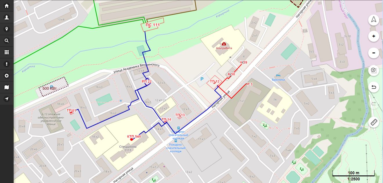
Interactive map
- Spatial data visualization
- Engineering network on the map
- Additional external WMS/WMTS sources
Attribute data
- Table forms for the object search
- Attribute editing
- Electronic document attaching
Access control
- User authorization
- Role based access
- Monitoring of users actions
Reports
- Output to Excel
- Printing map fragment
Integration component
- API
- Output to exchange data format
- Integration with vehicle tracking systems
Modeling
- Network calculations
- Simulation of accidents and switching
xMedia Web Server features
With xMedia Web Server you get
Spatial data access
- Engineering network on the map
- Object search and highlighting on the map
- Object geometry editing
- Setting additional sources of map data
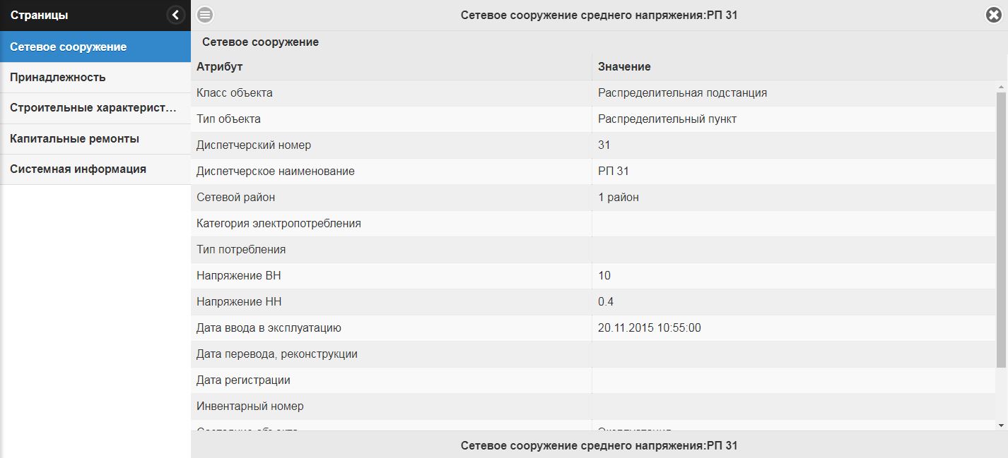
Attribute data access
- System objects search by the set of attributes
- View objects data
- Edit object data
- Electronic documents attaching – scanned copies, photos and other
- Ability to integrate with electronic document archives or telemetry systems
Projects
xMedia Web Server portal is used